Drone Services

Hydro-Terra Group is now offering state of
the art drone technology services!

Drone Services

Hydro-Terra Group is now offering state of the art drone technology services!

What We Do

Whether your business specializes in construction, mining, agriculture, manufacturing, emergency management, or you simply own property or equipment that would benefit from an aerial inspection, HTG can assist you.

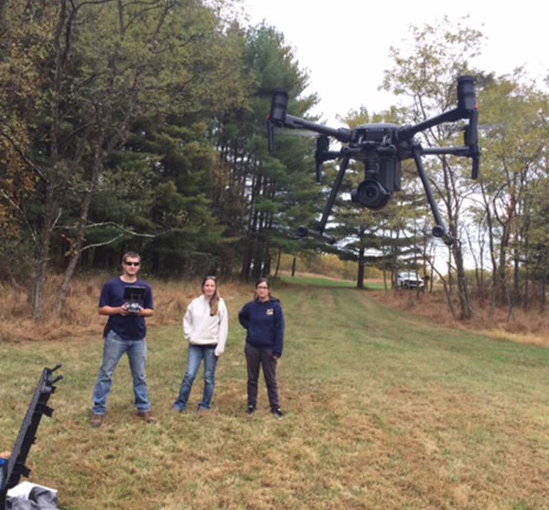
Hydro-Terra Group has the ability to assess your needs and plan your drone project from beginning to end. HTG has three in-house FAA- licensed, unmanned aircraft remote pilots, and expertise to:

  • Optimize data collection;
  • Safely plan and complete each flight;
  • Collect and process the highest quality images and data;
  • Create a custom visual output.

What We Do

Whether your business specializes in construction, mining, agriculture, manufacturing, emergency management, or you simply own property or equipment that would benefit from an aerial inspection, HTG can assist you.

Hydro-Terra Group has the ability to assess your needs and plan your drone project from beginning to end. HTG has three in-house FAA- licensed, unmanned aircraft remote pilots, and expertise to:

  • Optimize data collection;
  • Safely plan and complete each flight;
  • Collect and process the highest quality images and data;
  • Create a custom visual output.

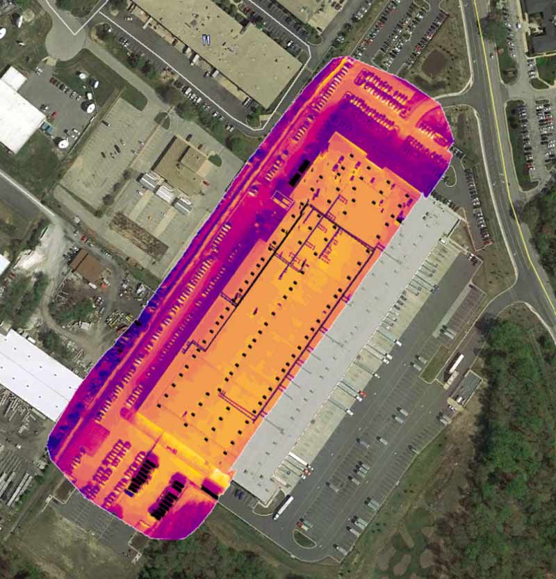
HTG has the capability to collect both thermal (radiometric) and photogrammetric data.

The data sets can be used to take precise and accurate measurements and create high quality maps and models including 2D and 3D topographic maps and Digital Surface Models (DSM); thermal reflectance and index maps; and high resolution (20.9 megapixels) photographs and Orthomosaics. The imagery and thermal data can also be evaluated in real time to reveal details not visible to the naked eye.

HTG has the capability to collect both thermal (radiometric) and photogrammetric data.

The data sets can be used to take precise and accurate measurements and create high quality maps and models including 2D and 3D topographic maps and Digital Surface Models (DSM); thermal reflectance and index maps; and high resolution (20.9 megapixels) photographs and Orthomosaics. The imagery and thermal data can also be evaluated in real time to reveal details not visible to the naked eye.

3.5 million drones

The FAA estimates that small, hobbyist drones
will triple in number to 3.5 million drones by 2021.

181,000 registered

Over 181,000 Americans have
registered their drones with the FAA.

422,000 drones

The number of U.S. commercial drones is
expected to grow to more than 420,000 by 2021.

3.5 million drones

The FAA estimates that small, hobbyist drones
will triple in number to 3.5 million drones by 2021.

181,000 registered

Over 181,000 Americans have
registered their drones with the FAA.

422,000 drones

The number of U.S. commercial drones is
expected to grow to more than 420,000 by 2021.

HTG uses the following software and equipment to provide the highest quality of services:

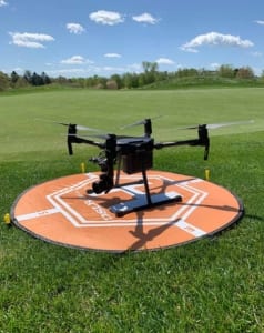
  • DJI Matrice 200 Drone – The industry’s top recommended high-performance drone with advanced flight stability
  • Parrot Bebop 2 Thermal Drone – Lightweight drone for indoor and outdoor use
  • DJI Zenmuse X5S – Camera designed specifically for high-end professional aerial imaging
  • DJI Zenmuse XT2 R – Dual sensor thermal imaging and visual camera capable of collecting real time absolute temperature (radiometric) data
  • DJI Pilot – a robust application for flight control
  • PIX4D Mapper – A leading photogrammetry software for professional data processing and mapping
  • Surfer – An extensive modeling software to display data with accuracy and precision
  • ArcGIS – The most well know software used to create georeferenced maps, perform spatial analysis, and manage geographic data

HTG uses the following software and equipment to provide the highest quality of services:

  • DJI Matrice 200 Drone – The industry’s top recommended high-performance drone with advanced flight stability
  • Parrot Bebop 2 Thermal Drone – Lightweight drone for indoor and outdoor use
  • DJI Zenmuse X5S – Camera designed specifically for high-end professional aerial imaging
  • DJI Zenmuse XT2 R – Dual sensor thermal imaging and visual camera capable of collecting real time absolute temperature (radiometric) data
  • DJI Pilot – a robust application for flight control
  • PIX4D Mapper – A leading photogrammetry software for professional data processing and mapping
  • Surfer – An extensive modeling software to display data with accuracy and precision
  • ArcGIS – The most well know software used to create georeferenced maps, perform spatial analysis, and manage geographic data

Did You Know

Drones can provide a safer, faster, cheaper alternative method to aircraft, helicopter, and other aerial imaging techniques. They can ultimately save lives, reduce workplace accidents, decrease the amount of time employees may be exposed to hazards, and make it quick and easy to provide measurements and evaluations of areas with dangerous equipment or at heights.

Drones are used in a wide variety of industries for a wide variety of applications including, but not limited to the following:

  • create accurate 3D models
  • document construction project progression
  • measure and manage stockpile, cuts, and fills
  • locate water infiltration to a roof or from a retaining wall
  • inspect buildings and roofs for leaks or damage
  • identify groundwater springs and seeps
  • inspect dangerous equipment
  • inspect equipment at heights
  • reveal when equipment is damaged or broken
  • document erosion
  • evaluate structural geology
  • conduct fracture trace analysis
  • monitor sinkholes and subsidence
  • record mass movement over time
  • delineate wetlands
  • find and reduce sources heat loss in buildings
  • detect electrical system overloads and insulator leaks
  • locate leaks in hot water and radiant heat systems and floors
  • locate high temperature hot water (HTHW) leaks
  • find costly steam leaks
  • inspect solar panels
  • assist firefighters with heat and fire tracking
  • monitor temperature of coal storage containers
  • detect equipment which is under stress
  • survey land
  • analyze crop health
  • evaluate property damage
  • determine the most damaged areas after a disaster
  • locate missing people
  • inspect radio, cell, and water towers for areas in need of maintenance
  • mapping of inaccessible terrain
200 people

Drones assisted rescuers locate and stabilize more than 200 individuals in a series of devastating floods in India in 2015.

55%

The usage of drones on construction sites has led to about a 55% increase in the safety of the workers.

Hydro-Terra Group

Resources

Well Volume Calculator

Our tool makes it fast and simple to calculate the volume, thus saving time in the field.

Materials Calculator

Our tool makes it fast and simple to calculate the volume and weight, thus saving time in the field.

© Copyright - Hydro-Terra Group | All rights reserved. | MD 410-861-5376 | PA 717-980-5937